Subject: Southwestern United States
Period: 1880 (published)
Publication:
Color: Black & White
Size:
49 x 14.4 inches
124.5 x 36.6 cm
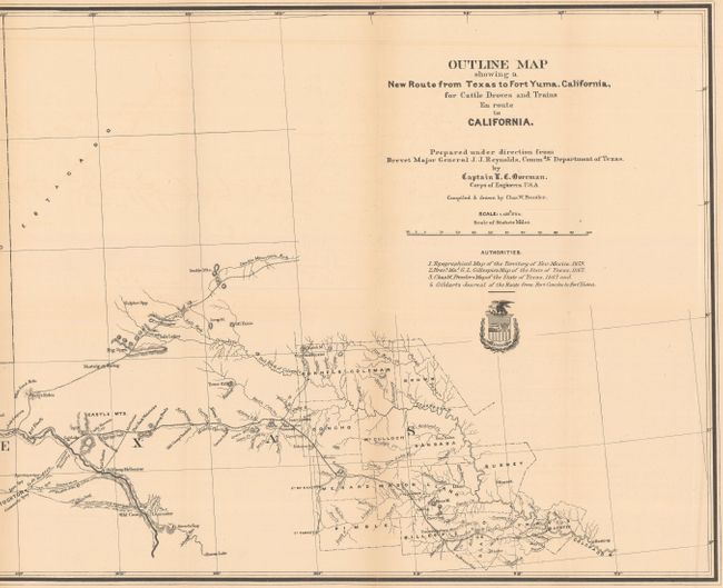
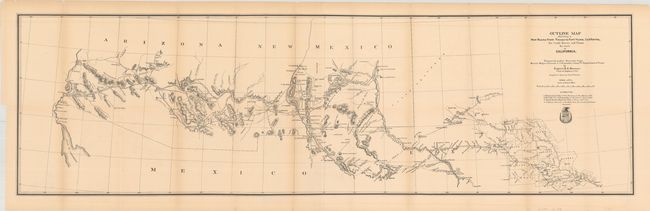
This unusual map, created by Capt. O.C. Overman, begins in Austin and shows in great detail the route to Fort Yuma, Arizona Territory. The route travels through numerous Army forts along the way: Cocho, Stockton, Quickman, Bliss, Selder, Commings, and the famous Ft. Bowie. It also passes though Maricopa Village and Wells and the Pima Villages, the site of today's Phoenix. There is remarkable detail of water holes, springs, grazing areas, missions, camps, Indian villages, and mines. The map lists four authorities including Pressler's Map of Texas (1867) and Gildart's Journal. The map's cartography is circa 1867, but it was published in a 1880 congressional report.
Condition: Folding as issue. Very good condition with mild toning on folds.
References: Wheat (TMW) #1216.
Condition: B+
Issued folding on lightly toned paper with some short splits along the folds, some of which have been closed on verso with archival tape.