Subject: Southwestern United States
Period: 1857-58 (published)
Publication:
Color: Hand Color
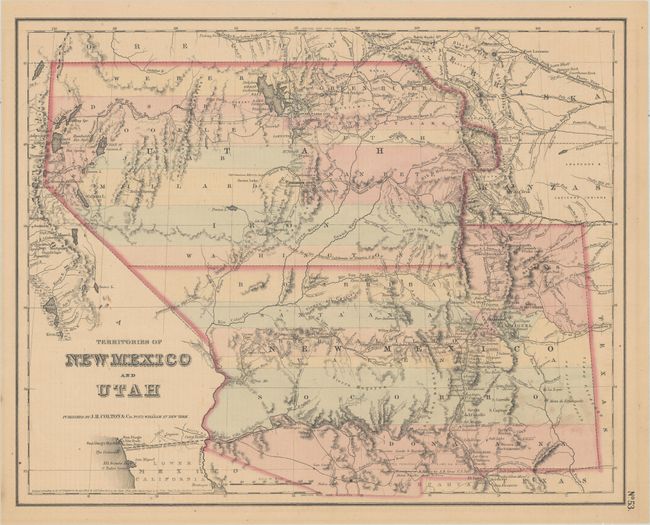
A. Territories of New Mexico and Utah, by J.H. Colton, from General Atlas, dated 1855 (14.6 x 11.7"). This iconic map depicts the largest extents of Utah and New Mexico territories. Utah extends from the Sierra Nevada Mountains to the Continental Divide with Fillmore City as its capital. New Mexico Territory stretches between California and Texas and includes part of present-day Colorado. It illustrates a number of important emigrant and exploratory routes, as well as three proposed routes for the Pacific Railroad. Although the copyright date is 1855, this state was published 1857-58. Referenes: Wheat [TMW] #832; Brown (Portolan - Spring 2005) pp. 48-51. Condition: Contemporary color with light toning and soiling. (B+)
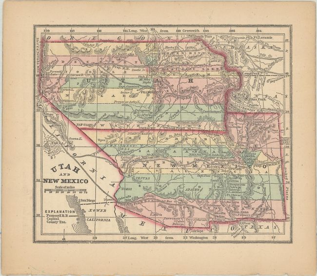
B. Utah and New Mexico, by Charles Colby, from The World in Miniature, published 1857 (6.0 x 5.0"). This is a miniature version of Colton’s map of the territories. It is nearly identical and thus carries a lot of information for a small map including the emigrant trails and proposed railway routes. Condition: Contemporary color with faint toning along the edges. (A)
References:
Condition:
See description above.