Subject: Colorado & Utah
Period: 1940 (circa)
Publication:
Color: Black & White
Size:
20.9 x 15.2 inches
53.1 x 38.6 cm
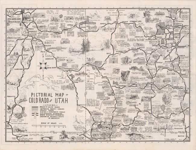
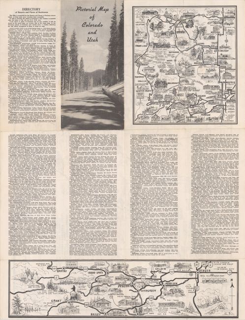
This pictorial map extends from Ft. Collins and Pueblo, Colorado west to Salt Lake City and Kanab, Utah. While no publisher is noted anywhere on the map or text, it was "presented by the Resorts and Places of Business...to help make your vacation more enjoyable." The map is both decorative and useful, with a legend identifying paved roads, improved roads, graded roads, hiking & horseback trails, and points of interest. Illustrations include historical landmarks, natural attractions, hotels, restaurants, and more. Descriptions of the 176 points of interest are found on verso and keyed to the main map. Verso includes two smaller maps covering Northern Colorado and the region from Denver west to Loveland Pass. Self-folding into pictorial wrappers (4.3 x 9.0"). No examples located on OCLC.
References:
Condition: A
Issued folding on a clean sheet with light wear along the fold lines.