Subject: Western United States
Period: 1872 (published)
Publication:
Color: Black & White
Size:
19.9 x 24.8 inches
50.5 x 63 cm
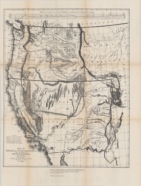
This is a British reproduction of the large-scale Preuss/Fremont map used in the British presentation in the Berlin Arbitration that settled the boundary dispute in the Northwest between Canada and the U.S. In the bottom margin the map is "“Certified to be a true Photo-zincographic copy." Published by the Ordnance Survey Office.
The original map was published by Congress to meet the demand for information concerning the California Gold Rush and is unquestionably one of the most important American maps of the 19th century. Among the most interesting features are the appearance of the term Golden Gate at the entrance to the Bay of San Francisco, the markings of the El Dorado or Gold Region in the California Gold Fields, a hypothetical east-west mountain range near the 42nd parallel, and a notation identifying the location of Mormon settlements for the first time. Wheat illustrates the map and devotes eight pages to its description.
References: cf. Wheat (TMW) #559.
Condition: B
Issued folding with light toning along the folds and two small edge tears at left (1" and 2") that have been closed on verso with tape.