Subject: Central United States
Period: 1843 (published)
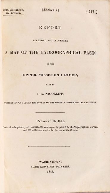
Publication: Sen. Ex. Doc. 237, 26th Congress, 2nd Session
Color: Black & White
Size:
30.5 x 36.5 inches
77.5 x 92.7 cm
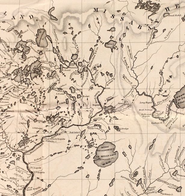
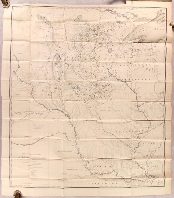
This extremely important map is the first accurate map of the interior region stretching from St. Louis north to the international boundary. The map was compiled by Lt. W. H. Emory (under the direction of Col. J. J. Albert) from the surveys of J. N. Nicollet, who was assisted by Lt. J. C. Fremont; thus, bringing together some of the most important names in the history of American mapping in the 19th century. Nicollet, already a noted French scientist and topographer, was chosen to lead this expedition (1838-40). The map reflects, for the first time, the use of the barometer to obtain elevations and the use of place names on maps based on a systematic analysis of Indian and French names. It is the first truly scientific topographical survey of the interior of North America. Contemporary cartographer, Lt. G. K. Warren, called it "one of the greatest contributions ever made to American geography." Lithographed by C. B. Graham and printed on two joined sheets.
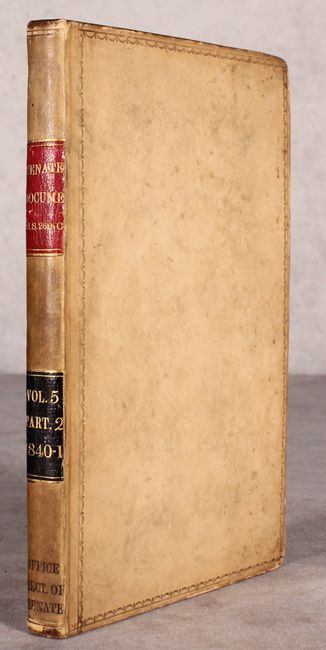
The map is still bound in the original "Report Intended to Illustrate a Map of the Hydrographical Basin of the Upper Mississippi River" (6 x 9") by Nicollet which describes his remarkable explorations on behalf of the Bureau of Topographical Engineers. A note explains Nicollet died while writing the introduction. Octavo, 170 pages. Hardbound in contemporary leather with gilt title labels on spine.
References: Claussen & Friis #390; Schwartz and Ehrenberg, p. 267-268, plt. 165.
Condition: B+
The folding map is very good on sturdy paper with some light offsetting, a few tiny splits at the fold junctions, and a 1.5" binding tear at left that has been closed on verso with archival tape. Text is mostly clean and tight with occasional foxing. Covers have light wear and minor soiling.