Subject: Texas & Oklahoma
Period: 1876 (dated)
Publication:
Color: Hand Color
Size:
16.4 x 23.9 inches
41.7 x 60.7 cm
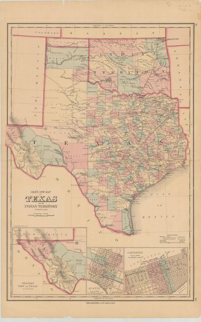
This terrific double-page map is filled with detail. It is the vertically oriented edition not to be confused with the horizontal edition from Gray's National Atlas. The state's rapid development is evident with only Young and Bexar Territories remaining unorganized. Wegefarth County, shown in Young Territory, was established in 1873 and abolished in 1876 by the legislature when they established the other Panhandle counties. Many railroads abruptly end between cities as the cartographer endeavored to show the exact progress to date. Details include numerous railroads, cities, towns, forts, and springs. Insets depict the Western Part of Texas, Austin, and Galveston. In Indian Territory the Public Lands are limited to the western panhandle.
References:
Condition: B+
There is light toning with a few minor edge chips and archival repairs to a 4" centerfold separation at left and some short tears confined to the blank margins.