Subject: Colonial Southeast United States
Period: 1764 (circa)
Publication: Le Petit Atlas Maritime
Color: Black & White
Size:
13.9 x 8.8 inches
35.3 x 22.4 cm
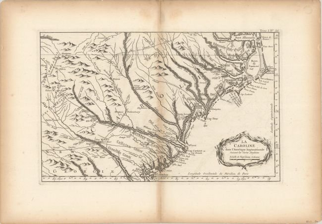
This wonderful map shows a rather compressed rendition of the coastline of both Carolinas, from Albemarle Sound (Baye Albermarle) and Pamlico Sound (Baye de Panticoe) at the north to St. Helene Sound to the south. It extends inland to the Cherokee Lands in the western Carolinas, Tennessee and Georgia. Several major interior roads cross paths at Augusta, GA and trading paths link the Indian villages with the colonial settlements. There are many recognizable settlements, rivers and other landmarks including the Granville Line in North Carolina. It is a fine map published during the time period immediately after the French and Indian War. Decorated with a wreath-style title cartouche.
References: Cumming (SE) #342.
Condition: B+
A crisp impression on watermarked paper with a bit of faint offsetting and light toning along the centerfold and sheet edges.