Subject: Colonial Mid-Atlantic United States
Period: 1764 (circa)
Publication: Le Petit Atlas Maritime
Color: Black & White
Size:
11.8 x 7.4 inches
30 x 18.8 cm
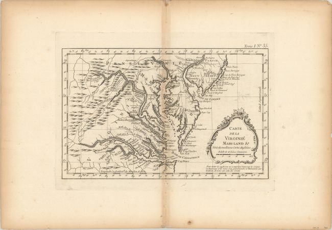
Finely engraved colonial map covering most of Virginia, Maryland, and Delaware, with a bit of Pennsylvania and New Jersey. The interior is fully engraved with mountains and great detail along the rivers. An early network of trails and wagon roads connects the communities along the seaboard and stretches as far west as Frederic Town ou Winchester, with one road continuing farther southwest beyond the James River. Fort Cumberland, Bukingham, and many frontier villages are located. A delicate rococo-style title cartouche completes the composition. This is a slightly enlarged and scarcer version of Carte de la Virginie, de la Baye Chesapeack, et Pays Voisins that was issued in Prevost's Histoire Generale des Voyages.
References:
Condition: B
A dark impression on a watermarked sheet with a bit of faint offsetting. There is light toning along the centerfold and sheet edges.