Subject: New England - United States
Period: 1820 (dated)
Publication: American Atlas
Color: Hand Color
Size:
21.4 x 26.6 inches
54.4 x 67.6 cm
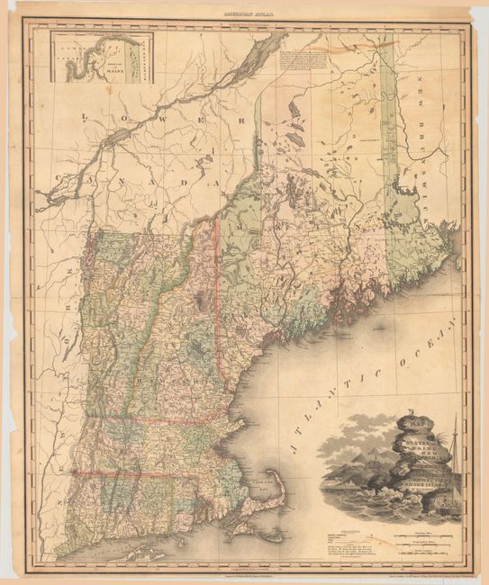
This large, attractive map of New England was published in Tanner's American Atlas, which is considered one of the finest American atlases ever published. Delineated by county, it is filled with detail of cities and towns, wagon roads, drainage and topography. The map also shows distances from county seats to the various state capitals. Includes a small inset of northern Maine at top left and a lengthy notation at top right indicating the border between Canada and Maine is "not perfectly correct, yet not materially far from the truth." Decorated by a title cartouche featuring a rugged coastline with pounding waves and a struggling sailboat.
Henry Schenck Tanner was one of the most productive and successful cartographic publishers of the early nineteenth century, a period known as the golden age of American cartography. The large, beautifully engraved maps from his American Atlas were considered among the "most splendid works of the kind ever executed in this country," as reported in the United States Gazette (Philadelphia) in 1823.
References: Phillips (Atlases) #4462-8.
Condition: B
A nice impression on a sheet that fully separated along the centerfold and has been skillfully rejoined with tissue on verso. There are several small repaired edge tears including two along the right border that extend about 1" into the image. Several small chips are confined to the margins.