Subject: Eastern United States
Period: 1871 (dated)
Publication: Geographische Mittheilungen
Color: Printed Color
Size:
16.3 x 9.7 inches
41.4 x 24.6 cm
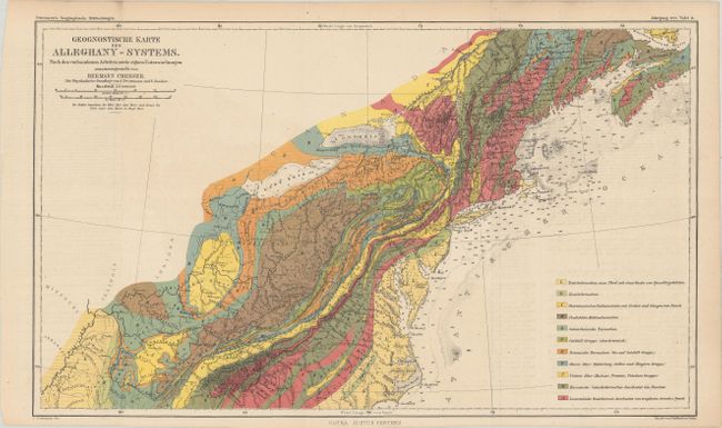
This detailed geological map of the northeastern United States was compiled by Hermann Credner, a German geologist and professor at the University of Leipzig at the time of publication. Attractively colored, the map is keyed to a legend identifying 11 different geological types including coal, granite, and more. Additional details include topography, river systems, and depth soundings along the coastline.
Dr. Augustus Herman Petermann's Geographische Mittheilungen was the oldest German trade magazine dedicated to geography. First published in 1855, the magazine covered many of the important discoveries of the 19th and 20th century until its end in 1937. Published by Justus Perthes in Gotha.
References:
Condition: A
Issued folding and now flattened and backed with tissue. There is faint offsetting from an opposing page of text.