Subject: Colonial Great Lakes, Florida
Period: 1785 (circa)
Publication: Atlante Novissimo
Color: Hand Color
Size:
16.7 x 12.1 inches
42.4 x 30.7 cm
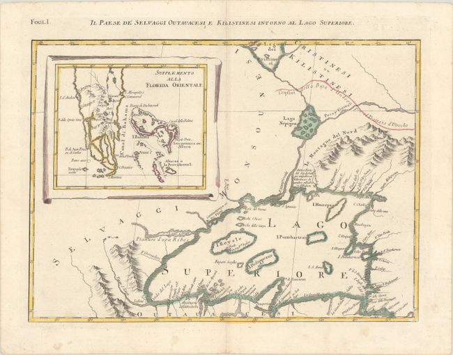
This is one sheet of Zatta's version of John Mitchell's epic and important map of the United States. The whole map was titled "Le Colonie Unite dell' America Settentrle" and was published as a set of twelve individual maps. This sheet depicts Lake Superior, based on the Bellin model. The lake is shown with the imaginary and persistent island of Philippeaux, and the Keweenaw Peninsula is crudely delineated and named Trasporto. A large inset "Supplemento alla Florida Orientale" shows the tip of southern Florida and the Bahamas. The title appears above the top border and translates, "The Country of the Savage Ottowas and Christineauz on the shores of Lake Superior."
References: Kershaw #980; Sellers and Van Ee #163; Shirley (BL Atlases) T.ZAT-1a #28.
Condition: A
On watermarked paper with minor soiling in the margins.