Catalog Archive
Auction 181, Lot 119

"Map of the Eastern Portion of British North America Including the Gulf of St. Lawrence, and Part of the New England States Compiled from the Latest Surveys and Charts", Andrews, Israel D.

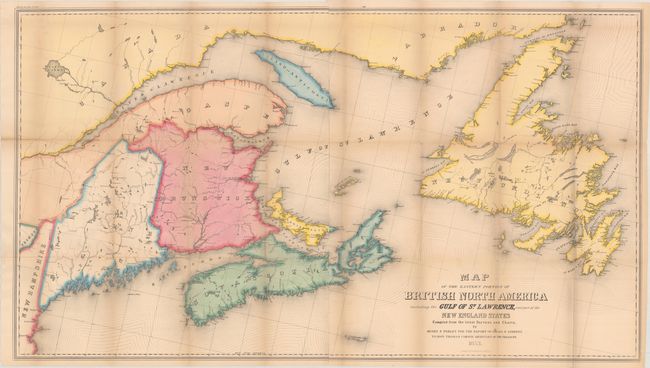
Subject: Northeastern United States & Canada

Period: 1853 (dated)

Publication: H.R. Doc. 136, 32nd Congress, 1st Session

Color: Hand Color

Size:
45.9 x 25.8 inches
116.6 x 65.5 cm
Download High Resolution Image
(or just click on image to launch the Zoom viewer)

This sizable map extends from Maine east through the Gulf of St. Lawrence to Newfoundland and Labrador. It emphasizes the rivers and lakes in the region and locates towns and settlements primarily along the coastline. Compiled by Henry Perley for Andrews' report. Printed on two sheets and joined. Andrews was a U.S. consul to Canada at the time and was a proponent of stronger economic relations between the two countries, and this map demonstrates their geographic interconnectedness. This is the first example of this map that we have seen in full hand color.

References:

Condition: B+

Issued folding with light toning and several short splits at the fold junctions.

Estimate: $180 - $220

Sold for: $70

Closed on 2/10/2021

Archived