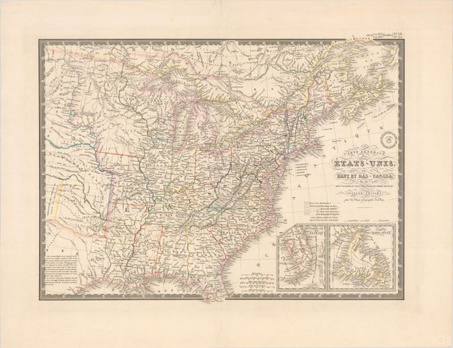
Subject: Eastern United States & Canada, Texas
Period: 1843 (circa)
Publication:
Color: Hand Color
Size:
20.1 x 14.8 inches
51.1 x 37.6 cm
An uncommon and finely engraved map covering all the eastern United States to about the 100th meridian, with a portion of southern Canada. The northwestern territories include a large Iowa Territory and Terre Du Nord Ouest that encompasses present-day Wisconsin, the Upper Peninsula of Michigan, and eastern Minnesota. The rest of the West past Missouri and Arkansas is designated as Indian Districts. The eastern half of the Republic of Texas is shown but is mostly blank with a lengthy notation filling its interior. Insets of the tip of Florida and Newfoundland are located in the lower right. Surrounded by a decorative keyboard-style border that indicates longitude from Paris. The handsome map includes fancy title lettering embellished with flourishes and Brue's embossed seal.
References:
Condition: A
A crisp impression on a clean sheet with a short edge tear along the top sheet edge that has been closed on verso with hinge tape.