Subject: St. Lawrence River, Canada
Period: 1757 (dated)
Publication: Histoire Generale des Voyages
Color: Black & White
Size:
11.8 x 7.4 inches
30 x 18.8 cm
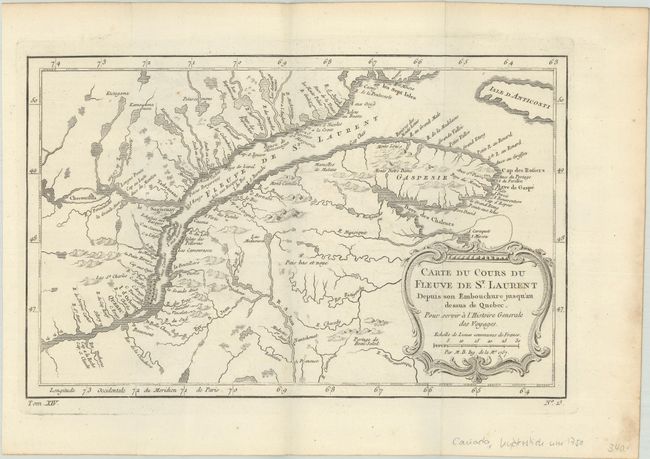
A. Carte du Cours du Fleuve de St Laurent Depuis son Embouchure Jusqu'au Dessus de Quebec. Pour Servir a l'Histoire Generale des Voyages (11.9 x 7.5"). Nice example of the first state of this copper engraved map, published by Prevost. The map details the course of the St. Lawrence River from Anticosti Island and the mouth west to beyond Quebec. It details many rocks and shoals in the river with numerous villages and forts located along the shore. Decorated with a rococo-style cartouche that includes a distance scale.
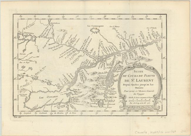
B. Suite du Cours du Fleuve de St. Laurent Depuis Quebec Jusqu'au Lac Ontario... (11.3 x 7.6"). A detailed map of the region between Lake Ontario and the St. Lawrence River to Quebec. The map extends to Lake Champlain and Lake George, as well as Lake Nepessing in Michigan, with numerous portages named on the interconnecting waterways. Locates Montreal. There are a number of forts named, including Ft. Toronto, Ft. Oswego, and Ft. Georges.
References: Kershaw #626 & #631.
Condition: A
Bright sheets, issued folding with a hint of offsetting and a couple of minor spots. There are small dampstains along the right edge of the sheet resulting in a few tiny tears.