Subject: North America, Texas
Period: 1845 (circa)
Publication: National Atlas
Color: Hand Color
Size:
19.5 x 24.2 inches
49.5 x 61.5 cm
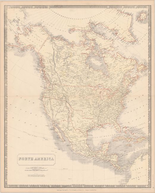
The Republic of Texas was a sovereign state in North America from 1836 to 1845. It was formed as a break-away republic from Mexico by the Texas Revolution. The nation claimed a large region that included all of the present state of Texas together with part of the former Mexican region of New Mexico (parts of present-day New Mexico, Oklahoma, Kansas, Colorado, and Wyoming). The eastern boundary with the United States was defined by the Adams-Onís Treaty between the United States and Spain, in 1819. Its southern and western-most boundary with Mexico was under dispute throughout the existence of the republic, with Texas claiming that the boundary was the Rio Grande, and Mexico claiming the Nueces River as the boundary.
This interesting map of North America shows much of the West in transition. Upper or New California takes up most of the Southwest of the United States, with a narrow finger of Mexico squeezed in between California and the independent Republic of Texas. Above California is Oregon Territory which shows the boundary with British America along the Columbia River, reflecting British claims in the region. There is good detail for a map of this scale, particularly of the river systems.
References:
Condition: A
Contemporary color with a few minute pin holes and light toning along the edges of the sheet.