Subject: North America, Texas
Period: 1836 (circa)
Publication: Olney's School Geography
Color: Hand Color
Size:
8.1 x 9.5 inches
20.6 x 24.1 cm
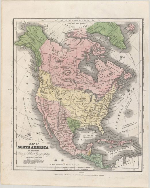
This great school geography map includes a large Independent Republic of Texas in its smaller configuration, with the Nueces River forming part of the western border and the Red River along the northern border. Locates Santa Fe, San Antonio de Bexar, and Austin. Above Texas is the Great American Desert. The United States extends to the Pacific with Astoria, Vancouver, and Ft. Wallah-Wallah named. The Northwest extends well into Canada geographically showing the Fifty-four Forty or Fight dispute with Britain, with a note that the boundary was determined in 1824. Mexico controls California and the Southwest while Alaska is Russian Possessions with the Aleutian Peninsula labeled Alaska. Cook's Inlet is well shown. States are not shown in the U.S. or Mexico, but the population of various cities are shown on the map. Numerous Indian tribes, major towns are named, and there is good detail of major rivers. The Great Basin is here called the Great Sandy Desert. Although the map is dated 1829, it shows boundaries circa 1836.
References:
Condition: A
A bright sheet with light soiling mostly confined to the blank margins.