Subject: Colonial North America
Period: 1780 (circa)
Publication:
Color: Black & White
Size:
12.6 x 8.4 inches
32 x 21.3 cm
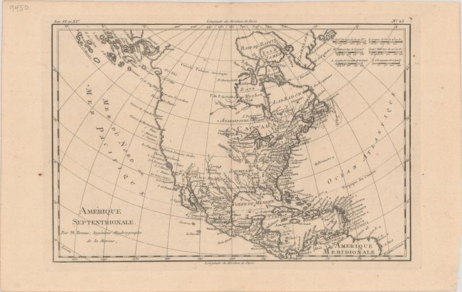
The entire western part of the continent is left mostly blank on this map of North America. Indian tribes occupy the edges of defined territory -- Apaches, Sioux, Outagamis, and Assenipouels. The British Colonies and a few major cities are named along the eastern seaboard and in the Great Lakes region. Alaska is shown as a group of islands, the largest of which is labeled Alaschka. Place names fill Mexico and the Caribbean.
References: Sellers & Van Ee #170.
Condition: A
A dark impression with a pair of wormholes only visible when held to light (below New Mexico and adjacent to Florida).