Subject: Pacific Ocean, World War II
Period: 1942 (circa)
Publication:
Color: Printed Color
Size:
38.8 x 28.7 inches
98.6 x 72.9 cm
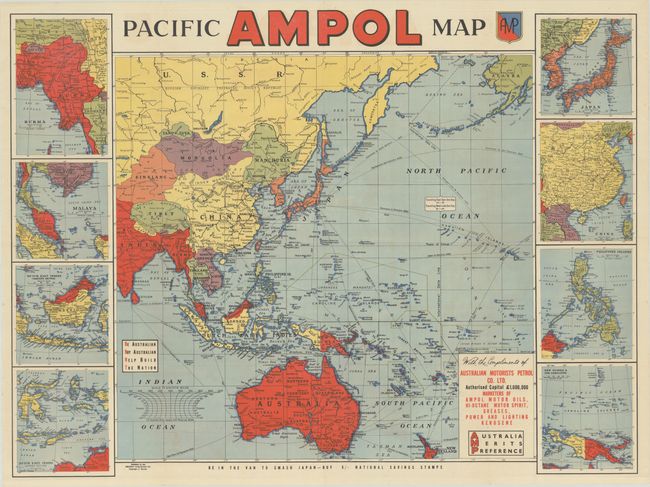
This large and colorful World War II-era map was published by the Gregory Publishing Co. for the Australian Motorists Petrol Co. Ltd. It extends from India and Soviet Northern Asia across the Pacific to Alaska and includes Tibet, China, Japan, the Philippines, Indonesia, Australia, Hawaii, and more. The main map is surrounded by 8 insets showing more detailed views of Burma, British Malaya, Dutch East Indies (both the western and eastern sections), Japan, China, the Philippines, and New Guinea and the Carolines. The ocean is filled with routes and distances between locations. A block of text at bottom right reads, "Be Australian / Buy Australian / Help Build / The Nation." Text across the bottom of the map encourages Australians to "be in the van to smash Japan" by buying national savings stamps.
References:
Condition: A
Issued folding with a few tiny holes at the fold intersections and a couple of minor spots.