Catalog Archive
Auction 180, Lot 737

"[On 2 Sheets] Carte de la Guinee Contenant les Isles du Cap Verd, le Senegal, la Cote de Guinee Proprement Dite, les Royaumes de Loango, Congo, Angola et Benguela...", Bonne/Lattre

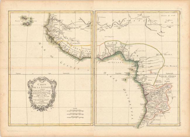
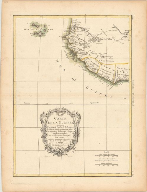
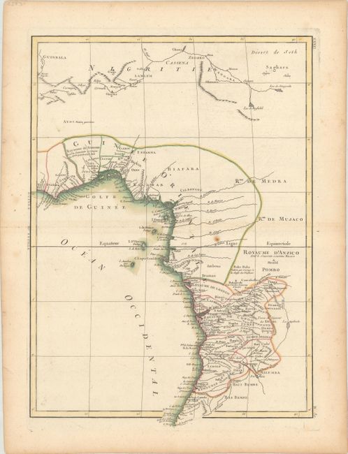
Subject: Western Africa

Period: 1771 (dated)

Publication:

Color: Hand Color

Size:
12.3 x 16.7 inches
31.2 x 42.4 cm
Download High Resolution Image
(or just click on image to launch the Zoom viewer)

This attractive map of Western Africa provides a detailed view of the coastal regions from Senegal to Angola. Political divisions, towns and cities, rivers, mountains, deserts, and more are identified. The interior of the continent is still largely unexplored. Cape Verde appears off the coast. Adorned by a decorative title cartouche and three distance scales.

References:

Condition: B+

Nice impressions on watermarked paper with minor scattered foxing. The eastern sheet has two tiny holes only visible when held to light. The first image is a composite image - the map is in two separate sheets.

Estimate: $150 - $180

Sold for: $90

Closed on 11/18/2020

Archived