Subject: Northwestern Africa
Period: 1730 (circa)
Publication:
Color: Hand Color
Size:
23.8 x 19.3 inches
60.5 x 49 cm
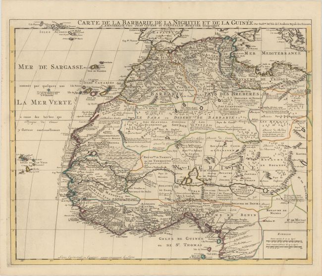
Deftly engraved 18th century map of western Africa from Barbary, Nigeria, and Guinea to below the equator. There is a mass of geographic detail and notations in the interior with information on the rivers and lakes. Numerous tent encampments are depicted throughout the Sahara Desert. A note at the eastern end of the Niger River explains that some believe that the Niger is an "arm of the Nile." This map first appeared in Delisle's Atlas de Geographie (1700-1712) and was here re-issued by Covens & Mortier, with their imprint below the title.
References: cf. Norwich #317.
Condition: A
A sharp impression with contemporary color on watermarked paper with one tiny hole in <i>Royaume de Mandinga.</i> A clean and bright example.