Subject: Western Hemisphere - America, Texas
Period: 1837-42 (dated)
Publication:
Color:
This lot features two maps depicting the Republic of Texas:
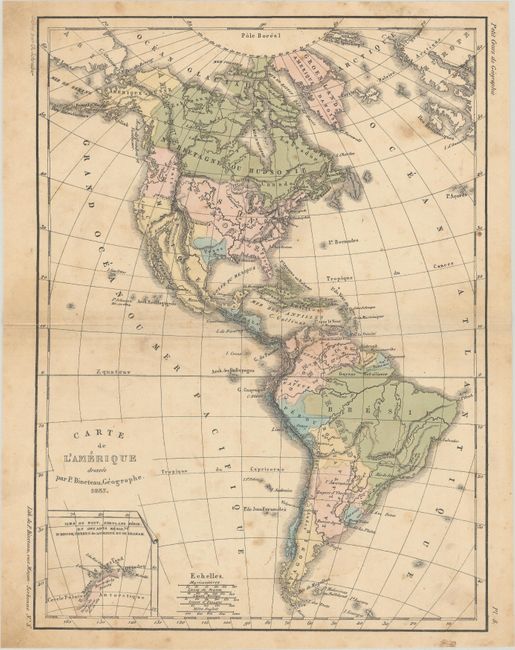
A. Carte de l’Amerique, by P. Bineteau, from Petit Cours de Geographie, dated 1837, hand color (8.2 x 11.0"). This French map shows an independent Texas in an unusual small configuration with only Houston being named. It is likely one of its earliest appearances of Houston on a map as it was established in 1836 and served as the capital only from 1837 to 1839. To its north, the United States boundary extends well into British Columbia, reflecting U.S. interests in the region. Includes a small inset of the tip of Antarctica at bottom left. Condition: Light scattered foxing with a small centerfold separation at left that has been closed on verso with archival tape.
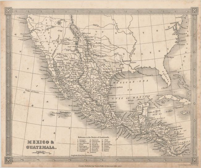
B. Mexico & Guatemala, by Alexander Findlay, dated 1842, black & white (9.6 x 7.8"). This map features the Independent Republic of Texas clearly labeled but without delineated boundaries. The map shows all of Upper or New California naming San Francisco, Santa Barbara, San Diego, etc. The Baja peninsula is Lr. or Old California. The Great Salt Lake is located as Youta or Gr. Salt L. The locations of many Indian tribes, forts and early settlements are noted. Published by Thomas Kelly. Condition: Light scattered foxing that is more prominent along the sheet edges.
References:
Condition: B+
See description above.