Subject: Africa
Period: 1600 (circa)
Publication: Thresor de Chartes...
Color: Hand Color
Size:
4.9 x 3.4 inches
12.4 x 8.6 cm
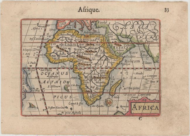
This map of Africa is interesting for its strange depiction of the Nile, which originates in a large lake south of the Equator. From this lake three large rivers flow to the seas: the Nile to the Mediterranean, the Congo to the Atlantic, and what could be the Zambeze to the Indian Ocean. Although this map is based on the Gastaldi-Ortelius and Mercator models, it includes the unique feature of a lake along the Equator into which both the two Ptolemaic lakes flow. The map is decorated with a strapwork title cartouche and three sea monsters, including a sea "lion." Though not signed, this map was likely engraved by either Jodocus Hondius or Petrus Kaerius, who engraved the majority of the maps of the Thresor de Chartres (Map Treasury). The map appeared in a French edition of Caert-Thresoor, published by Cornelis Claesz.
References: Betz #37; King (2nd ed.) pp. 80-82; Van der Krogt (Vol. III) 8600:341.
Condition: B+
There is one small rust spot along the northern coast of Africa and light soiling that is almost exclusively confined to the blank margins.