Subject: Java, Indonesia
Period: 1760 (circa)
Publication: Histoire Generale des Voyages
Color: Black & White
Size:
17.1 x 8.1 inches
43.4 x 20.6 cm
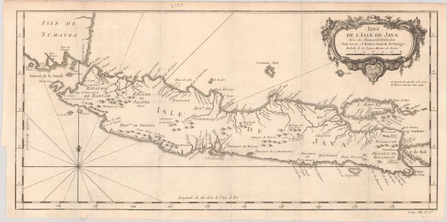
A. Idee de l'Isle de Java Tiree des Manuscrits Hollandois pour Servir a l'Histoire Generale des Voyages, (17.1 x 8.1"). This well engraved and attractive chart of the island shows all principal harbors and coastal details, plus rivers, mountains, volcanoes, bays, settlements, villages, and political districts. It locates Batavia (Jakarta) and includes Madura Island, most of Bali, the Sunda Strait with the Krakatau Islands, and the southeastern tip of Sumatra. The island is divided into provinces and the kingdoms of Bantam, Jacatra, Tsieribon, and Gressic. Decorated with a very fancy rococo-style title cartouche and rhumb lines with fleur-de-lys. At lower right, outside neatline, is "Tome VIII. No. Ire."
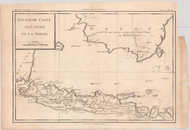
B. Deuxieme Carte des Isles de la Sonde, (13.5 x 9.3"). This handsome map of the island of Java extends to show the southern parts of Borneo and Sumatra. Detail is primarily confined to Java. A notation (in French) in the interior of Borneo states that the region is occupied by a nation of savages. At top right, outside neatline, is "Tom. 15. Pag. 401."
References:
Condition: A
Both maps are issued folding on watermarked paper with faint offsetting and a couple minor spots.