Subject: Red Sea
Period: 1600 (published)
Publication: Thresor de Chartes
Color: Hand Color
Size:
4.9 x 3.4 inches
12.4 x 8.6 cm
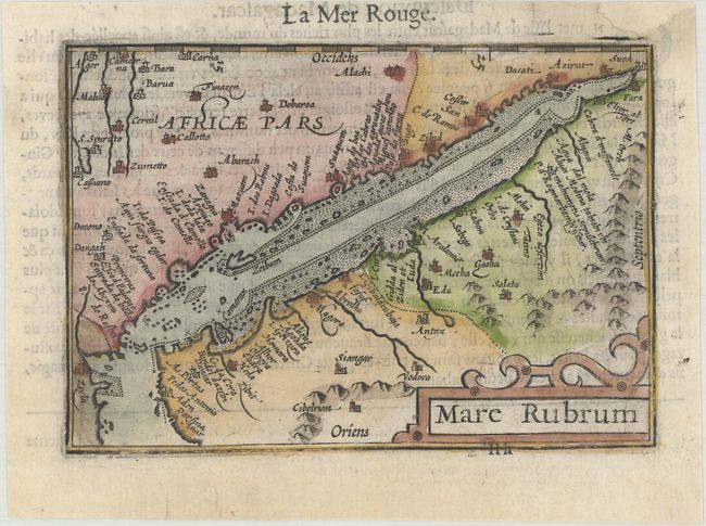
This miniature map centers on the Red Sea and spans from Suez down to Zaila in present-day Somalia. It features excellent detail along the coasts, identifying a number of isles, ports, and bays, and many towns and cities are named inland. North is oriented to the right. A decorative title cartouche appears at bottom right. French text on verso.
The map was first published by Cornelius Claesz and printed by Barent Langenes in the 1598 edition of the popular Map Treasury. For the 1599 edition, graduation lines and latitude numerals were added to one side of the border on most of the maps, which were again used for multiple editions through 1650. This is from a French edition, printed by Albert Hendricks.
References: King (2nd ed.) pp. 80-82; Van der Krogt (Vol. III) #0510:341.
Condition: A
A dark impression on a bright sheet with professional repairs to a chip at top right and a tear in the bottom blank margin.