Subject: Western Hemisphere - America
Period: 1729 (circa)
Publication: Introductio in Universam Geographicam
Color: Hand Color
Size:
10.3 x 8.1 inches
26.2 x 20.6 cm
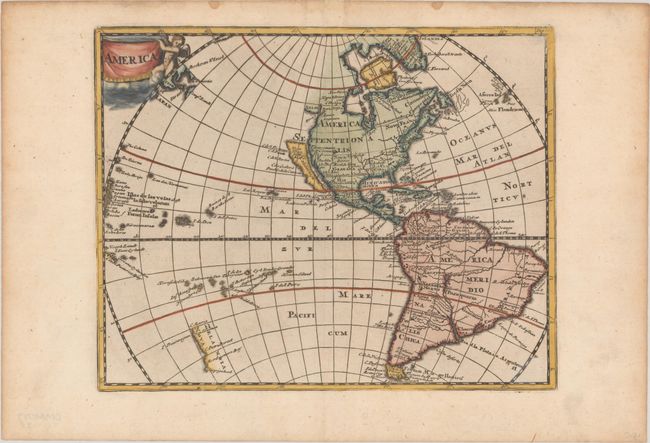
This handsome small map was derived from the Nicolas Visscher map of 1658, with a Briggs-type island of California and no Great Lakes in North America. The interior rivers of South America are all connected to a large, spurious lake labeled Lago de los Xarzyes. A depiction of the discoveries of Maarten Gerritsz de Vries' voyage appears in the waters north of Japan, and Abel Janszoon Tasman's discoveries are shown in New Zealand. The map is decorated by a drape-style title cartouche held aloft by a cherub. This is the second state of the map with page 666 at top right.
Cluver's Introductio in Universam Geographicam was a popular atlas, appearing in over 45 editions during a 100-year period. The first edition was published without maps in the 1620s, and the first edition to include maps was published circa 1641. The various editions were published in different cities throughout Europe, including Amsterdam, Nuremberg, and London. This map is from an edition published by Joannem Pauli or P. de Coup.
References: Burden #732; McLaughlin #177; Shirley (BL Atlases) T.CLUV-8a #43.
Condition: A
A sharp impression on a bright sheet with minor toning along the edges of the sheet and a few small damp stains along the top edge of the sheet.