Subject: Middle East
Period: 1768 (published)
Publication: Atlas Universel
Color: Hand Color
Size:
24.3 x 18.7 inches
61.7 x 47.5 cm
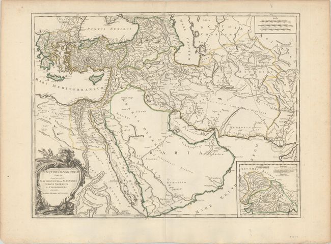
This is the second state of this large map of the ancient empires of the Middle East, with updates to the course of the Nile. This finely engraved map is centered on Arabia and extends to the Caspian Sea in the north, west to show Greece, east to the Indus River, and south to include all the Red Sea and the Nile River valley. There is good detail of topography, deserts, towns, and villages, etc. The interior of Arabia is very nearly blank. The campaigns of Alexander the Great (356-323 B.C.) are traced. A large inset shows northern India from the Indus River and the region of the Asiatic Sythians, with notes on Alexander the Great’s expeditions. Elisabeth Haussard engraved the large title cartouche that is embellished with military accoutrements, but in this state her imprint has been replaced with that of Groux.
References: Pedley #382.
Condition: A
A nice impression with contemporary outline color on a bright sheet with a small chapel watermark. There is marginal soiling and light toning along the edges of the sheet.