Subject: Middle East, Persia
Period: 1685-1788 (circa)
Publication:
Color: Hand Color
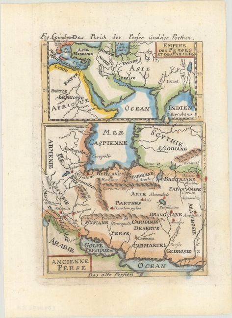
A. Empire des Perses et des Parthes [on sheet with] Ancienne Perse, by Alain Manesson Mallet, from Beschreibung des Gantzen Welt-Kreisses…, circa 1685 (4.1 x 5.9"). This sheet features two small maps of the Persian Empire under the Safavid dynasty and the surrounding region. The map at top spans from the eastern Mediterranean and northern Africa across the Middle East to the Ganges River and the unnamed mythical Lake Chiamay. The larger map at bottom zooms in on Persia with historical place names and some topographical detail. An alternate title in German appears above the neatline at top: Das Reich der Perser und der Porthen. Reference: Pastoureau, MANESSON-MALLET I B. Condition: On watermarked paper with a small spot and remnants of hinge tape on verso.
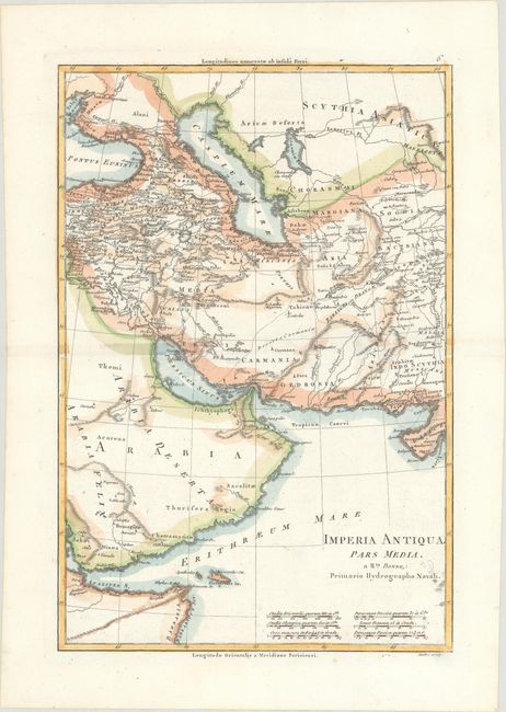
B. Imperia Antiqua Pars Media, by Rigobert Bonne, from Atlas Encyclopedique, circa 1788 (9.3 x 13.7"). This attractive map extends from the Black Sea and Arabian Peninsula east to the Indus River. It includes towns and cities, historical regions, deserts, and topographical detail. There are six distance scales at the bottom. Condition: On watermarked paper with a spot of minor soiling.
References:
Condition: A
See description above.