Subject: Eastern Mediterranean & Middle East
Period: 1664 (published)
Publication:
Color: Hand Color
Size:
18.9 x 12.5 inches
48 x 31.8 cm
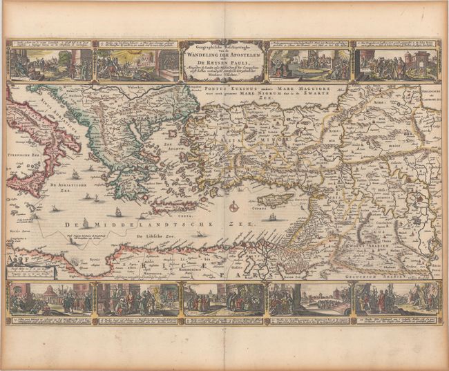
This map portrays the Eastern Mediterranean from Rome, through Asia Minor and the Holy Land, to Babylon. Territorial divisions reflect the political conditions of the first century A.D. The route of Apostle Paul is charted from Jerusalem to Rome. The decorative panels at top and bottom are taken from the elder Visscher's similar map. They show the major events of Paul's journey; each vignette being a composite of two or three episodes. The one at the left of the cartouche shows Paul blinded on the road to Damascus, his baptism by Ananias, and finally his daring escape from the city. Other scenes depict the young Paul before his conversion, healing the paralytic, his ship wreck at Malta, and his appearance before Nero. Engraved by A. vanden Broeck, first state. Dutch text on verso.
References: Poortman & Augusteijn #123.
Condition: B+
A crisp impression on a bright sheet with minor soiling, toning along the edges of the sheet, and narrow side margins, as issued.