Subject: Greece
Period: 1688 (circa)
Publication:
Color: Hand Color
Size:
20.1 x 17.4 inches
51.1 x 44.2 cm
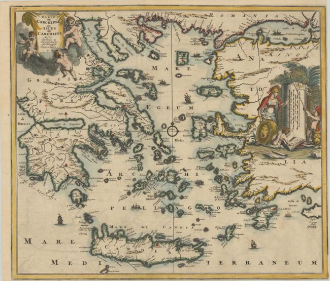
An uncommon map of Greece and the Greek islands, extending to the western coast of Turkey. The map is handsomely embellished with a title cartouche held aloft by putti, a large distance scale featuring Athena, and tiny ships sailing in the Aegean Sea. This map was published in Naukeurige Beschryving der Eilanden, in de Archipel der Middelantsche Zee in 1688 and then again in a French edition, Description Exacte des Isles de l’Archipel, et de Quelques Autres Adjacentes in 1703. Both editions contained this map with the title in French.
References: Shirley (BL Atlases) G.DAPP-5a #1; Zacharakis #878.
Condition: B+
A dark impression issued folding with light offsetting. Trimmed close to the neatline at right and bottom.