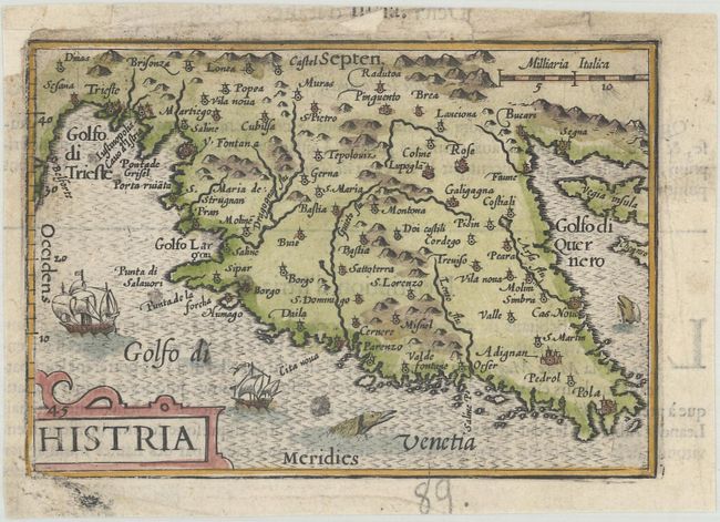
Subject: Istria Peninsula, Croatia
Period: 1600 (published)
Publication: Thresor de Chartes
Color: Hand Color
Size:
4.9 x 3.4 inches
12.4 x 8.6 cm
Charming miniature map covering the Istria Peninsula in modern day Croatia. The moiré patterned sea is filled with tiny ships and sea monsters. French text on verso.
The map was first published by Cornelius Claesz and printed by Barent Langenes in the 1598 edition of the popular Map Treasury. For the 1599 edition, graduation lines and latitude numerals were added to one side of the border on most of the maps, which were again used for multiple editions through 1650. This is from a French edition, printed by Albert Hendricks.
References: King (2nd ed.) pp. 80-82; Van der Krogt (Vol. III) #7180:341.
Condition: B+
A nice impression with minor soiling and professional repairs to several chips in the blank margins.