Subject: Romania & Hungary
Period: 1683 (published)
Publication: The English Atlas
Color: Hand Color
Size:
18.9 x 14.9 inches
48 x 37.8 cm
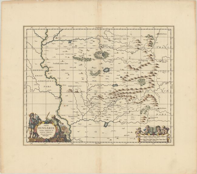
This very uncommon and beautiful map covers the area east of the Tibiscus (Tisza) River in present-day Hungary and Romania. It identifies many towns and cities and includes some nice topographical detail. The map locates the Mezosegh or Transylvanian Plain. There is a striking title cartouche at bottom left that depicts Christian soldiers facing off against an Ottoman soldier with a burning building and scared children in the background. The distance scale cartouche features four putti hoisting an open atlas. Blank verso.
This was published in the third volume of The English Atlas. It includes the number "XV" at top right and a graticule that were not present on previous Jansson editions. The atlas was projected to be a 12-volume work in the tradition of the earlier Dutch atlases and was to use updated copperplates belonging to Johannes Jansson van Waesberge, son-in-law and heir of Jan Jansson. Only 4 volumes were completed before the venture failed and Pitt was thrown into debtor's prison.
References: Van der Krogt (Vol. I) #2810:1.2.
Condition: A
A fine impression with wide margins. There is a small rust spot above the title cartouche, and a minor crease and hint of toning along the centerfold.