Subject: Eastern Europe, Poland
Period: 1794 (dated)
Publication:
Color: Hand Color
Size:
10.5 x 8.5 inches
26.7 x 21.6 cm
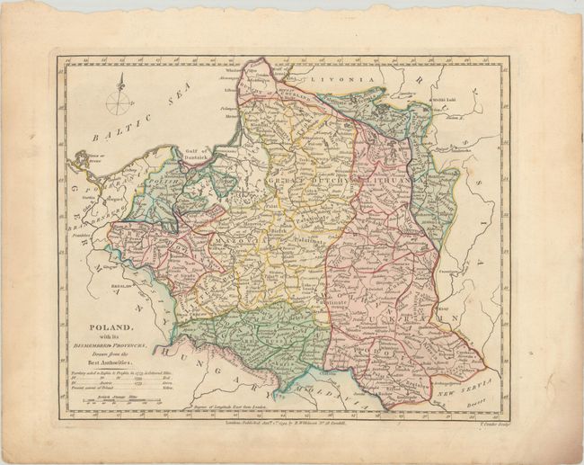
Great map of the Prussian Empire that extends from Oder River in the west to Kiev and the Dnieper River in the east, as well as north to Riga and south to the Carpathian Mountains; thus extending from modern-day Poland into parts of modern Latvia, Lithuania, Kaliningrad, Belarus and Ukraine. Numerous towns, rivers, and geo-political subdivisions are shown. The map focuses on the "dismembered provinces" of Poland, identifying by color which lands were ceded to Russia, Prussia and Austria between 1773-93. Engraved by T. Conder.
References:
Condition: B+
Full contemporary color on a sheet with a "1794 J. Whatman" watermark, very light soiling, a few spots of foxing, and damp stains confined to the blank margins.