Subject: Eastern Europe, Russia
Period: 1697 (published)
Publication: Introductio in Universam Geographicam
Color: Hand Color
Size:
9.9 x 9.3 inches
25.1 x 23.6 cm
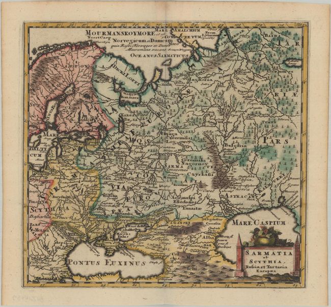
This handsome copper engraved map of the region extends from Poland to the Ural Mountains and from Scandinavia to the Black and Caspian Seas. Fully engraved, it depicts mountains, forests, and towns, with many ancient place names. Decorative title cartouche at lower right.
Cluver's Introductio in Universam Geographicam was a popular atlas, appearing in over 45 editions during a 100-year period. The first edition was published without maps in the 1620s, and the first edition to include maps was published circa 1641. The various editions were published in different cities throughout Europe, including Amsterdam, Nuremberg, and London. This map is from an Amsterdam edition published by Jan Wolters.
References: Shirley (BL Atlases) T.CLUV-8a #29.
Condition: A
A dark impression, issued folding on a bright sheet with toning along the centerfold at top and edges of the sheet.