Catalog Archive
Auction 180, Lot 501

"[Lot of 2] Parte Settentrionale degli Stati dell' Elettore di Colonia [and] Parte Meridionale degli Stati dell' Elet: di Colonia", Coronelli, Vincenzo Maria

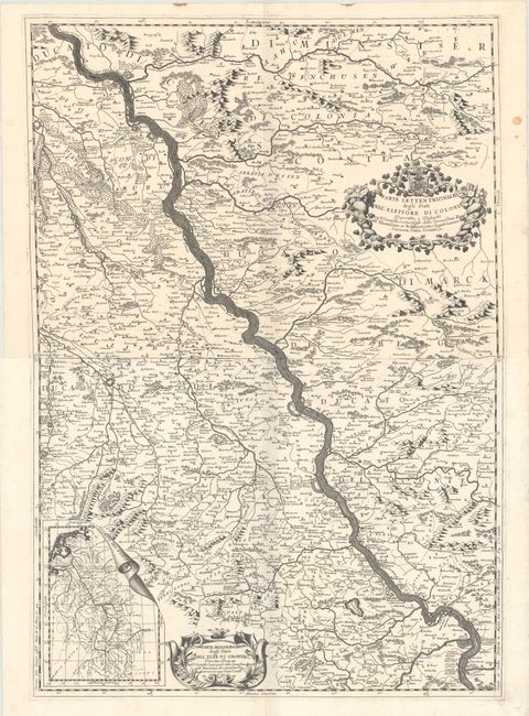
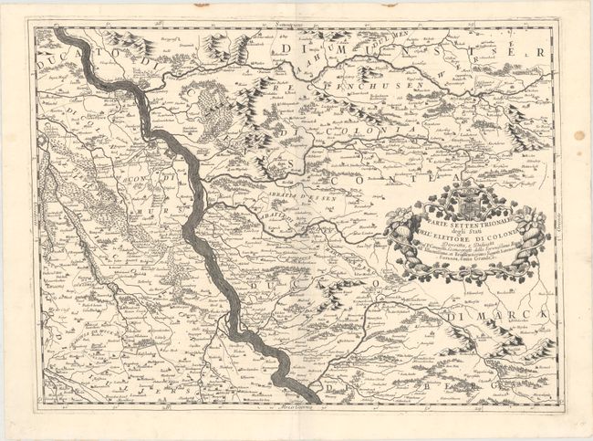
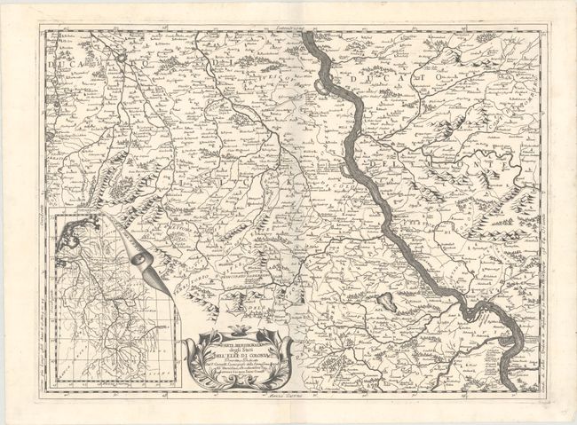
Subject: Western Germany

Period: 1690 (circa)

Publication:

Color: Black & White

Size:
23.6 x 17.5 inches
59.9 x 44.5 cm
Download High Resolution Image
(or just click on image to launch the Zoom viewer)

This sharply engraved pair of maps detail the former extent of the Archbishopric of Cologne along the Rhine River valley from Wesel in the north to Koblenz on the southern map, including a multitude of cities and towns along the way. The topography is shown pictorially, and in the lower left of the southern map is an inset of the whole course of the Rhine. Both maps have richly engraved cartouches and stand on their own.

References:

Condition: A

Both maps have dark impressions on strong sheets of laid paper. The northern sheet has some minor marginal stains and one short tear in the lower left margin, not affecting the map. The first image is a composite image - the map is in two separate sheets.

Estimate: $500 - $650

Sold for: $350

Closed on 11/18/2020

Archived