Subject: Spain & Portugal
Period: 1548 (circa)
Publication: La Geografia di Claudio Ptolemeo Alessandrino
Color: Black & White
Size:
6.8 x 5 inches
17.3 x 12.7 cm
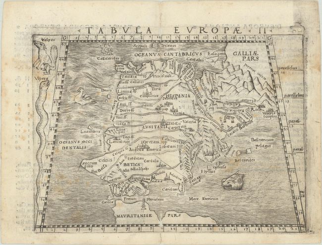
This copperplate Ptolemaic map of the Iberian Peninsula prominently features the Pyrenees and the rivers of the region. Key cities are marked with miniature castles. Two sea monsters lurk in the waves of the Atlantic and Mediterranean and a fox and a viper appear left of the map. Italian text on verso.
Gastaldi's edition of Ptolemy's Geography was conceived as the first "pocket" or miniature atlas. His monumental work was the most comprehensive atlas produced between Waldseemuller's Geographiae of 1513 and Ortelius' Theatrum of 1570.
References: Mickwitz & Miekkavaara #214-3.
Condition: B
There are several worm tracks along the centerfold that have been archivally repaired and moderate scattered foxing.