Subject: Southern France
Period: 1594 (dated)
Publication: Theatrum Orbis Terrarum
Color: Hand Color
Size:
20.1 x 13.7 inches
51.1 x 34.8 cm
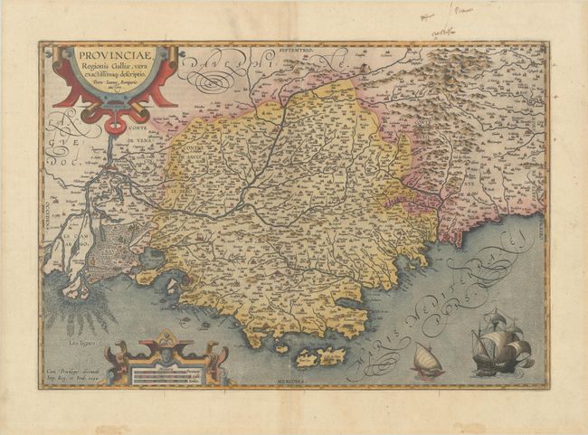
This superb map of the region of Provence along the Mediterranean extends from the Camargue region in the west to past Nice in the east, and as far north as Gap. The Rhone River delta is well depicted, and the Durance River is shown winding through the region. The map is filled with tiny villages, and larger cities are depicted as castles, including Marseille, Nice, Aix, Avignon, and Arles. The map is handsomely adorned with a pair of sailing ships and two strapwork cartouches. The map is based on Jean Pierre de Bompar's single-sheet map of Provence published in 1591. Dated 1594 and published in either 1608 or 1612 with Italian text on verso.
References: Van den Broecke #47.
Condition: B+
A nice impression on a bright sheet with the horn coat of arms watermark commonly found on Ortelius maps. There is light toning along the centerfold, marginal soiling, and minor creases in the blank margins.