Subject: Western Europe, Rhine River
Period: 1783 (dated)
Publication:
Color: Hand Color
Size:
19.1 x 23.5 inches
48.5 x 59.7 cm
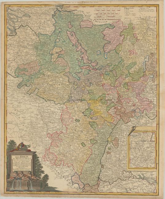
This handsome and richly detailed map covers the course of the Rhine from the North Sea to Boden See (Lake Constance). It shows parts of the Netherlands, Belgium, Luxembourg, France, Germany, and Switzerland. The region is divided into its political divisions, and there is nice topographical detail. A key at top right indicates capital cities, villages, abbeys, fortified towns, country and post roads, and more. An inset at bottom right shows the origin of the Rhine. The map is further adorned with four distance scales and a title cartouche featuring a river god and goddesses, a caduceus, lute, and other allegorical symbols. Engraved by Johann Michael Schmidt.
References:
Condition: B+
There are light dampstains at top, right, and bottom. Short edge tears along the left and bottom edges, a couple of which cross the neatline, have been closed on verso with archival materials. Part of the alternative French title in the top margin has been trimmed away.