Catalog Archive
Auction 180, Lot 424

"[Lot of 2] L'Escosse dela le Tay, Divisee en Toutes ses Provinces: Tirees des Cartes Particulieres de Timot Pont, de R. Gordon a Straloch &c. [and] L'Escosse deca le Tay, Divisee en ses Provinces &c...", Sanson/Mariette
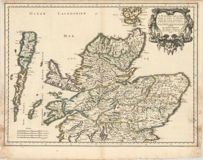
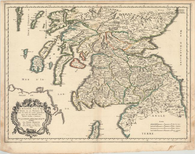
Subject: Scotland

Period: 1665 (dated)

Publication: Cartes Generales de Toutes les Parties du Monde…

Color: Hand Color

Size:
21.4 x 15.9 inches
54.4 x 40.4 cm
Download High Resolution Image
(or just click on image to launch the Zoom viewer)

These two maps together provide a complete view of Scotland from the Orkney Islands in the north to Carlisle and Durham, England in the south. The map extends west to include the Outer Hebrides and the northern coast of Ireland and is filled with details of political boundaries, towns, mountains, and rivers. Each map is decorated with an exquisite title cartouche, distance scales, and borders. Based on the cartography of Timothy Pont and Robert Gordon, per the inscriptions.

References: Pastoureau, SANSON V B [119] & [120].

Condition: B+

Contemporary outline color on watermarked paper. There are light dampstains primarily in the margins at lower left and right that have been reinforced on verso with old paper.

Estimate: $375 - $450

Sold for: $275

Closed on 11/18/2020

Archived