Subject: London, England
Period: 1856 (circa)
Publication:
Color: Hand Color
Size:
23.4 x 23.8 inches
59.4 x 60.5 cm
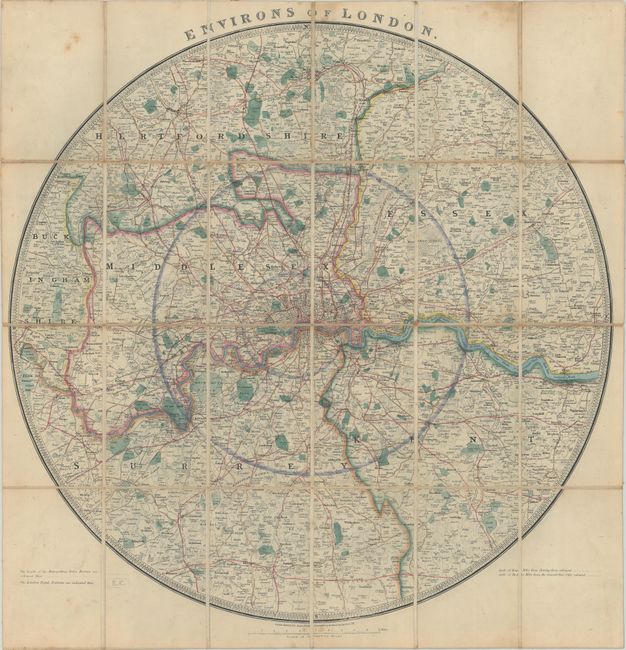
This handsome and unusual circular map centers on London and extends to Welwyn in the north, beyond Reigate in the south, Slough in the west, and Stanford-le-Hope in the east. There is excellent detail of counties, parks, roads, and railways. London itself is laid out in plan form. This example is a later edition with the addition of Battersea and Victoria parks and the London, Brighton, and New Kent railways. Dissected and linen-backed.
References: Howgego #344 (5).
Condition: B+
There is light scattered foxing and soiling, much of it outside the map image, and a few small splits in the linen at fold intersections.