Subject: Central England
Period: 1680 (circa)
Publication: Britannia
Color: Hand Color
Size:
16.9 x 12.1 inches
42.9 x 30.7 cm
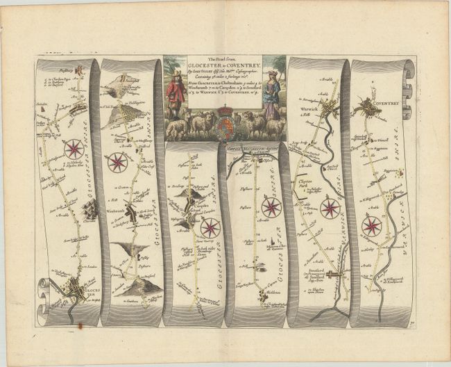
John Ogilby's 'Britannia' was published between 1675 and 1698. It is a landmark in the mapping of England and Wales. Its unique format constituted the first national road-atlas of any country in Western Europe. It was composed of maps of seventy-three major roads and cross-roads, presented in a continuous strip-form, on a uniform scale of one inch to a mile. Each beautiful map includes wonderful detail of the countryside with each strip containing a large compass rose to indicate changes in direction.
This map features the road from Gloucester through Winchcombe, Campden, Stratford upon Avon, and Warwick to Coventry. It is in the pictorial style pioneered by Ogilby with the road laid out in several ribbon-like panels. The road is 58 miles long as it moves through the villages of Cheltenham, Winchcomb, Arrable, Mickleton, Stretford, and more. The stone quarry near Arrable is located just south of the road branching to Stow. Each of the six panels has a decorative compass rose to orient the traveler. The cartouche includes a pastoral scene of a shepherd and shepherdess and their flock of sheep.
References:
Condition: A
A crisp impression on a bright sheet with a bunch of grapes watermark and full margins. There is one rust spot at lower left on the neatline, otherwise fine.