Catalog Archive
Auction 180, Lot 40
"Table Geografique pour Scavoir Combien il y a de Lieues Entre les Principales Villes de l'Europe", Mortier, Pierre
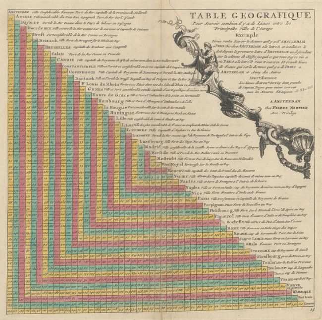
Subject: Cartographic Miscellany
Period: 1705 (published)
Publication:
Color: Hand Color
Size:
12 x 11.6 inches
30.5 x 29.5 cm
Download High Resolution Image
(or just click on image to launch the Zoom viewer)
(or just click on image to launch the Zoom viewer)