Subject: Europe
Period: 1850 (circa)
Publication: Atlas Universel Illustre
Color: Hand Color
Size:
17 x 10.9 inches
43.2 x 27.7 cm
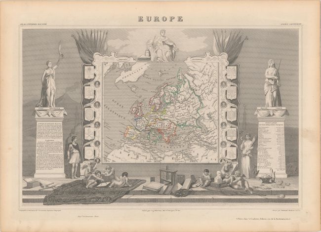
Victor Levasseur's "Atlas National Illustre" and "Atlas Universel Illustre" are among the last decorative atlases published. The maps are all lavishly illustrated with scenes of the countryside, products and activities indigenous to the region.
Very handsome map of Europe that includes Greenland, Iceland & the Arctic Circle. The surrounding engravings make this one of the most decorative maps of the 19th century. The map itself is framed by medallion portraits and coats of arms down each side, and is set against a background of statues and allegorical figures with a large group of adorable cherubs engaged in academic pursuits filling the foreground. Drawn and engraved by Raimond Bonheur and published by A. Combette in Paris.
References:
Condition: A
A crisp impression with contemporary outline color and light toning along the edges of the sheet.