Subject: Tierra del Fuego & Falkland Islands
Period: 1770-80 (circa)
Publication: Atlas Encyclopedique
Color: Hand Color
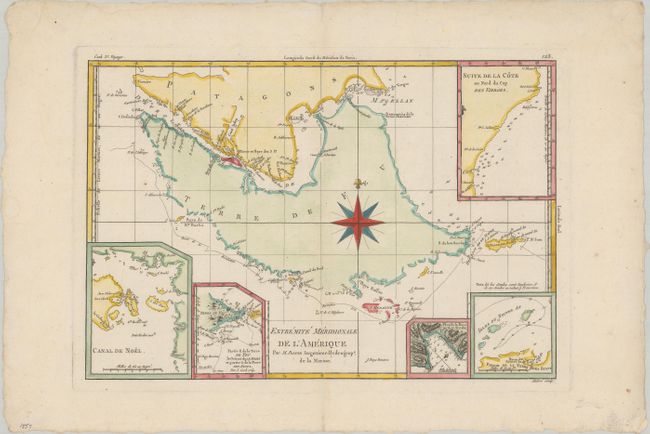
A. Extremite Meridionale de l'Amerique, circa 1770 (13.5 x 9.1"). This copper-engraved sheet of Tierra del Fuego is centered on a large compass rose. The map details the treacherous track through the Straits of Magellan. Five insets show bays, small groups of islands, soundings, rocks, and anchorages. Engraved by Andre. Condition: A clean, bright sheet of watermarked paper with deckled-edges and minor marginal soiling. (A)
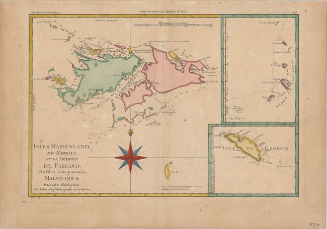
B. Isles Maidenland, de Hawkins, et le Detroit de Falkland. Ces Isles sont Nommees Malouines, par les Francois, circa 1780 (13.5 x 9.2"). This chart shows the Falkland Islands with ship's tracks and depth soundings around the islands. These strategically important islands were contested between France, Spain and Britain through much of the eighteenth century. Commodore Byron claimed the islands for Britain in 1765. Captain James Cook's discoveries in 1775 of the South Sandwich Islands and the island of Georgia are depicted in inset charts. Engraved by Andre. Condition: Lightly toned with a few small spots of foxing. (B+)
References:
Condition:
See description above.