Catalog Archive
Auction 180, Lot 381

"Carte de la Partie Meridionale de l'Amerique Meridionale avec la Route du Centurion, Depuis l'Ile Ste. Catherine...", Anson, George

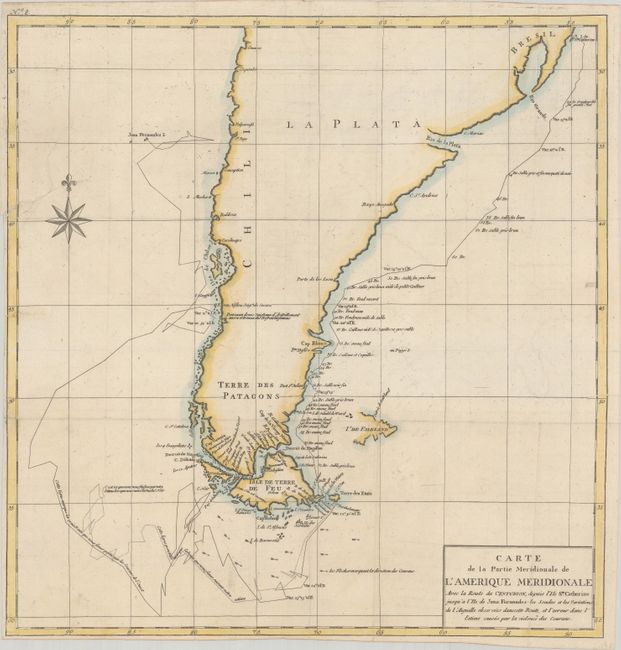
Subject: Southern South America

Period: 1770 (circa)

Publication: Voyage Autour du Monde...

Color: Hand Color

Size:
19 x 19.7 inches
48.3 x 50 cm
Download High Resolution Image
(or just click on image to launch the Zoom viewer)

This is the larger edition of this handsome chart showing the route of Capt. George Anson's expedition from St. Catherine's Island off the coast of Brazil, around Cape Horn and up to Juan Fernandes Island (now known as Robinson Crusoe Island) off the coast of Chili. During the War of Jenkins' Ear, Anson's expedition of eight ships was sent to harass the Spaniards along the coast of South America. Seven of his ships were lost on the trek around Cape Horn and Chile with a loss of 600 men.

References: cf. Shirley (BL Atlases) G.ANS-2a.

Condition: B+

A crisp impression, issued folding on a bright sheet with minor offsetting and two archivally repaired tears that enter 1" and 3" into image at left. Trimmed close to the neatline at left and bottom.

Estimate: $140 - $170

Unsold

Closed on 11/18/2020

Archived