Subject: Equador
Period: 1751 (dated)
Publication:
Color: Black & White
Size:
13.9 x 23.4 inches
35.3 x 59.4 cm
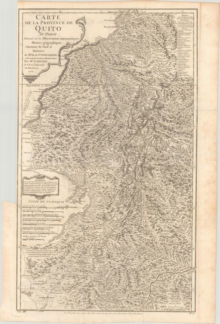
A detailed map from Condamine's survey of 1735-49 to determine the curvature of the earth at the equator, published by D'Anville. The map shows the triangulation points used in the valley between Quito and Cuenca. The map is decorated with two cartouches and eight scales of miles. This map is the result of one of the most important scientific expeditions in cartographic history; its primary intention being to determine the precise length of a degree of longitude in the region of the equator in order to calculate the size and shape of the globe. Condamine then explored the entire course of the Amazon on his return to France. This expedition to South America became famous, due to both the scientific findings and the incredible adventures experienced by its members.
References:
Condition: B+
Issued folding with faint offsetting and a binding trim at left. Light scattered foxing is confined to the blank margins.