Subject: South America
Period: 1720 (circa)
Publication: Atlas Historique
Color: Black & White
Size:
20.3 x 15.8 inches
51.6 x 40.1 cm
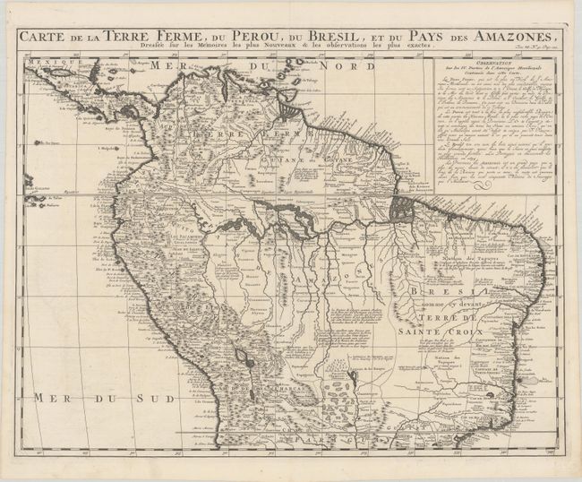
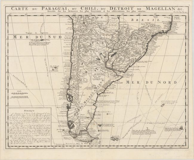
A lovely matching pair of maps representing the entire South American continent:
A. Carte de la Terre Ferme, du Perou, du Bresil, et du Pays des Amazones... Handsome map of the northern part of South America based on the cartography of Guillaume Delisle. It is filled with place names and notations speculating about the Indian tribes and the tributaries of the Amazon. The Capitaineries are named in Brazil and the Inca Way (Grand chemin des Ingas) is shown from Chuquisaca in Peru to Pasto in Colombia. A notation in Guyana notes the mythical Lac de Parime on which the golden city of Manoa del Dorado was supposed to be located. The central part of the map (Pays des Amazones) is filled with Indian names.
B. Carte du Paraguai, du Chili, du Detroit de Magellan &c... Large, finely engraved map of the southern part of South America with great topographical detail and notations throughout. The tracks of several explorations are noted in both oceans and Amerigo Vespucci's ship is shown sailing in the Atlantic. A depiction of a water fowl is also shown in the Atlantic, with a note that there are a lot of animals in the arctic waters that are "half bird and half fish."
References:
Condition: A+
Sharp impressions on bright sheets with Strasbourg Bend & Lily watermarks and a few tiny, insignificant spots.