Subject: Southwestern United States & Mexico
Period: 1830 (circa)
Publication:
Color: Hand Color
Size:
12.4 x 17.8 inches
31.5 x 45.2 cm
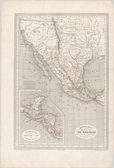
This scarce map depicts Mexico extending north to the 42nd parallel and east to the Sabine River as established by the Adams-Onis Treaty of 1819. The provinces of Mexico are delineated and named, including Texas and "Nouveau Mexique." There are only a few place names identified in Texas including San Antonio, San Felipe and Nacogdoches. Arkansas, Missouri, Louisiana and Mississippi are noted but not delineated on the map. The western topography is represented in hachure and is based on the expeditions of Lewis and Clark, Pike and Long. Includes an inset of Central America at bottom left. Engraved by Grenier.
References:
Condition: A
A nice impression with contemporary outline color on a bright sheet with a couple of short edge tears that have been archivally repaired.