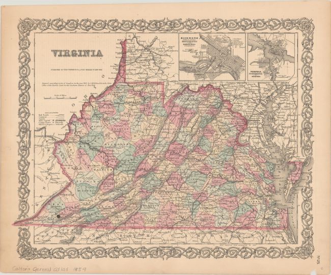
Subject: Virginia
Period: 1855 (dated)
Publication: Colton's General Atlas
Color: Hand Color
Size:
16 x 12.9 inches
40.6 x 32.8 cm
Nice map of pre-Civil War Virginia, before the separation of West Virginia in 1863. West Virginia is one of only two states formed during the Civil War; the other is Nevada. The map provides fine detail of towns, roads, canals, railways and much topographical information. At upper right are two inset maps: Richmond Henrico County, Manchester and Spring Hill; and Norfolk, Portsmouth and Gosport. All surrounded by Colton's decorative scroll border.
References:
Condition: B+
There is one small rust spot in the image and light toning mostly in the blank margins. A small chip is confined to the bottom blank margin.