Subject: Virginia
Period: 1847 (circa)
Publication: A New Universal Atlas
Color: Hand Color
Size:
14.3 x 11.4 inches
36.3 x 29 cm
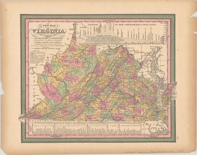
An attractive map that shows Virginia before West Virginia separated itself due to the secession of Virginia from the Union. County configurations are current to 1847 with the creation of Highland County from Bath County. The map presents good detail of topography, rivers, towns and settlements. It shows only a few railroads at this time including lines from Baltimore to Winchester and Cumberland, MD, and lines from Richmond extending to Gordonsville, Fredericksburg, Petersburg, and Norfolk. Includes an elevation profile of the Chesapeake & Ohio Canal at top. A table at bottom lists Steam Boat Routes including Richmond to Norfolk, Richmond to Washington, Richmond to Baltimore, Wheeling to Pittsburgh, and Wheeling to Cincinnati. Fancy titling and decorative border.
References:
Condition: B+
Full original color with toning along the sheet edges and several small chips confined to the blank margins.