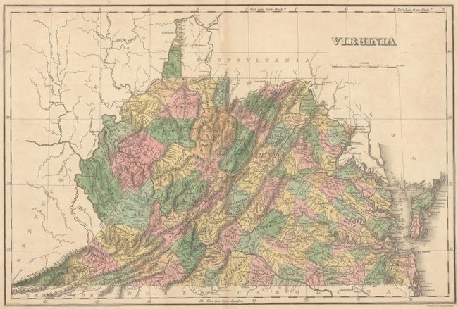
Subject: Virginia
Period: 1822 (published)
Publication: A Complete Historical, Chronological, and Geographical American Atlas...
Color: Hand Color
Size:
18.3 x 12.1 inches
46.5 x 30.7 cm
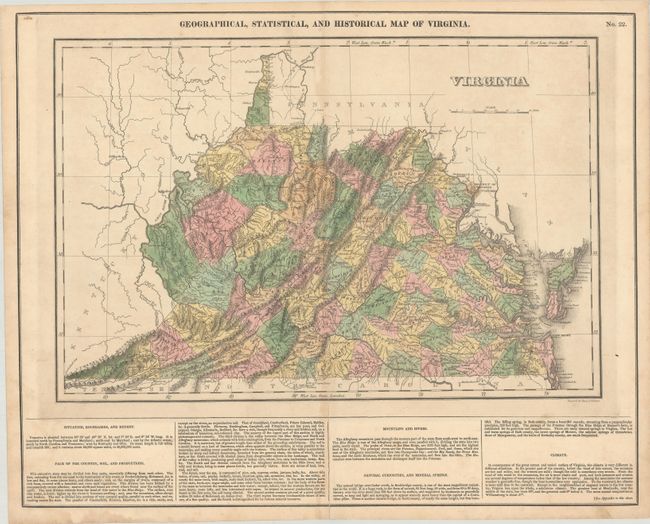
This map is on a full folio sheet (20.6 x 16.6") with English text below giving a brief description of the state’s boundaries, mountains and rivers, climate and "natural curiosities." Delineated by county, the map is filled with detail of cities and towns, wagon roads, drainage and topography. County development is current to 1820 with the addition of Morgan in the northern part of the state. Several battle sites in the Tidewater region including Jamestown, Yorktown and Norfolk are depicted with red flags. Engraved by Young & Delleker.
References: Phillips (Maps) p. 986.
Condition: B+
There is minor toning and a centerfold separation at bottom that extends 3" into the image that has been closed on verso with archival materials.